Hey there, fellow history explorers and map enthusiasts! You know, there’s a unique kind of thrill that comes from tracing the lines on an old map. They’re so much more than just geographical representations; they’re silent storytellers, whispering tales of ancient empires, forgotten trade routes, and the very evolution of human civilization.
When I first started delving into the historical maps of Eritrea, I truly felt like I was embarking on a captivating journey through time. This incredible corner of the world, often overlooked in mainstream historical narratives, boasts a past rich with diverse cultures and pivotal global events.
What I discovered through these old charts and cartographic masterpieces was a vibrant tapestry, revealing how Eritrea’s landscape and identity were shaped by a confluence of influences, from indigenous kingdoms to powerful colonial forces.
It gives you such a profound appreciation for the layers of history that exist beneath our modern world, and truly helps us understand the present. It’s like holding a direct link to centuries gone by, offering insights you just can’t get from a textbook alone.
Let’s uncover these incredible stories together.
Unveiling Ancient Echoes: Eritrea’s Early Cartographic Footprints

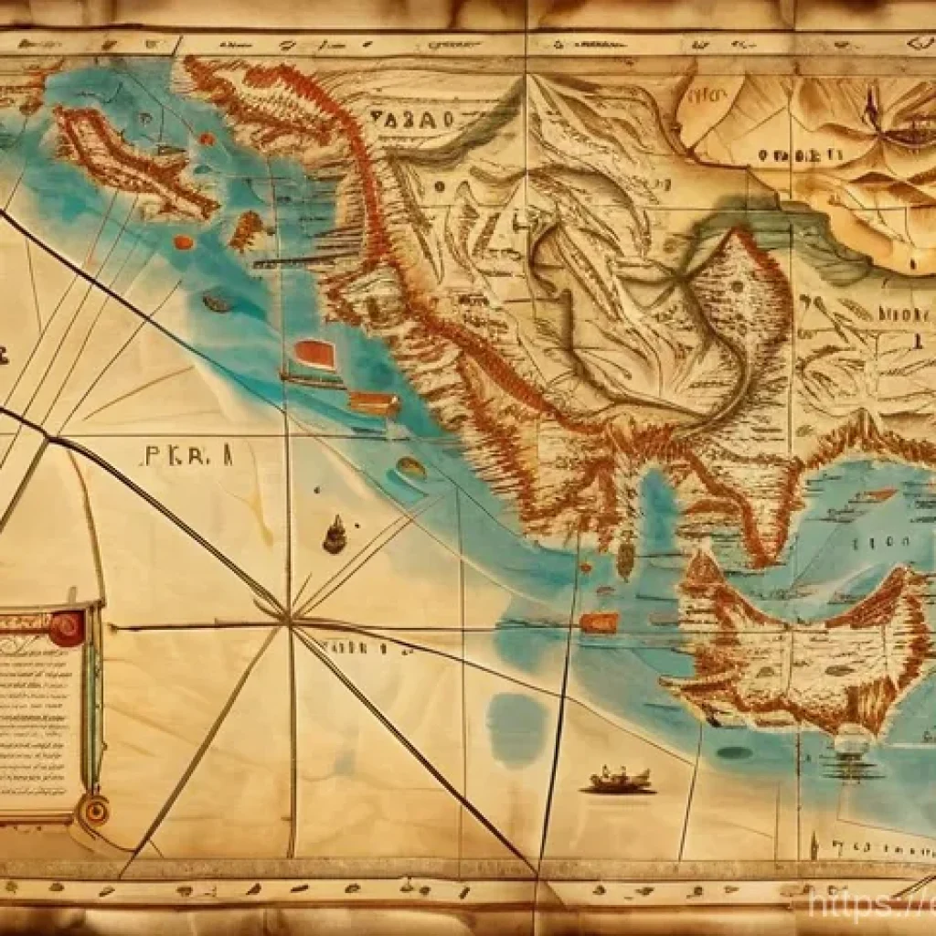
Stepping back in time through the lens of ancient maps, you truly begin to grasp Eritrea’s profound historical significance, stretching far beyond what many might casually assume. Imagine holding a parchment, its edges softened by centuries, depicting trade routes that once pulsed with life across the Red Sea and deep into the heart of Africa. These aren’t just lines on a page; they’re the ghost trails of caravans laden with exotic goods, of intrepid explorers pushing the boundaries of the known world, and of empires vying for control over this crucial gateway. My initial dives into these older charts were nothing short of breathtaking. I recall one particular 1864 map by Augustus Petermann and Bruno Hassenstein that really pulled me in, detailing explorer routes from the Red Sea towards Sudan, complete with meticulous notes on local languages and elevations. It’s like these cartographers, with their painstaking attention to detail, were trying to tell us something vital, something about the very essence of human connection and ambition, all laid out across a canvas of shifting sands and formidable mountains. What truly struck me was seeing how Massawa, now a major port, was already marked as a critical hub, even being eyed by the Portuguese, Ottomans, and Egyptians long before the Italians arrived. It brings a real sense of perspective to the enduring importance of this coastal region, a silent testament to countless generations who understood its strategic value.
The Red Sea’s Enduring Allure on Early Maps
The Red Sea, from which Eritrea derives its name, has always been a magnet for empires and traders, and the maps reflect this beautifully. Looking at centuries-old nautical charts, you see the careful delineation of coastlines, the placement of islands like the Dahlak Archipelago, and the routes meticulously charted by sailors risking everything for trade and discovery. These aren’t just geographical representations; they’re stories of adventure, of cultural exchange, and sometimes, of fierce competition. You can almost feel the salt spray and hear the creak of wooden ships as you trace the paths on these antique documents. I found myself thinking about the sheer audacity of those early mariners, navigating by stars and rudimentary instruments, piecing together the world one coastline at a time. It’s humbling, really, to see how much of our modern understanding of global connectivity stems from these ancient voyages, all meticulously documented on maps that have somehow survived the ravages of time.
Ancient Kingdoms and Their Territorial Footprints
Before the colonial era drastically redrew the lines, Eritrea was home to powerful indigenous kingdoms whose presence is subtly yet significantly hinted at in older cartography. The Kingdom of Aksum, for instance, a formidable trading empire thriving from roughly 100 to 940 AD, encompassed much of what is now Eritrea and northern Ethiopia. While specific Aksumite maps in the modern sense might be scarce, historical documents and later European interpretations often show the broad influence and territorial claims of such entities. These maps, even when drawn centuries later, offer glimpses into how these early civilizations perceived and organized their lands, often aligning with natural geographical features like rivers and highlands. It really makes you ponder the fluid nature of borders and identities throughout history, long before the rigid lines of nation-states took hold. My personal take is that these early depictions, however imperfect, are invaluable for understanding the deep historical roots of Eritrean identity, predating external influences and reminding us of a rich, self-governing past.
Colonial Eras and the Cartographic Scramble for Control
The late 19th and early 20th centuries saw a dramatic shift in how Eritrea was depicted on maps, largely due to the infamous ‘Scramble for Africa.’ This period introduced a whole new layer of cartographic detail, but also a stark, often brutal, reimagining of the region’s geopolitical landscape. As European powers carved up the continent, maps became instruments of imperial ambition, showcasing newly claimed territories and meticulously planned infrastructure projects. Italy, for instance, established its colony of Eritrea in 1890, and suddenly, countless maps emerged, designed not just for navigation but for asserting influence and supporting military operations. I’ve spent hours poring over these Italian colonial maps, like the “Colonia Eritrea” from 1895, published by Antonio Vallardi. They’re incredibly detailed, showing strategic locations and transportation routes, reflecting Italy’s deep desire to control this vital Red Sea gateway. It’s a somber experience, realizing that these beautifully crafted maps, with their vibrant colors and precise lines, represent a period of profound disruption and restructuring for the local populations. They serve as a powerful visual record of a time when external powers dictated destinies, forever altering the physical and cultural geography of the region.
Italy’s Vision: Redrawing the Eritrean Landscape
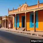
Italian cartography of Eritrea is particularly fascinating, offering a window into their colonial ambitions and the systematic way they approached territorial control. They weren’t just drawing borders; they were planning cities, roads, and agricultural ventures. Maps from this era often highlight Asmara, which became the capital, and the crucial port of Massawa, showcasing the infrastructure they built to connect these vital points. It’s like seeing a blueprint for an empire unfold across the page. These maps also vividly illustrate the extent of Italian influence, showing Eritrea enlarged with northern Ethiopian regions during the Fascist period, creating “Italian East Africa” in Mussolini’s grand vision. The sheer volume and detail of these maps demonstrate a serious, long-term commitment to their colonial project, which, while ultimately transient, left an indelible mark on the region’s physical and administrative layout. It’s a stark reminder of how maps can be powerful tools, not just for representing reality, but for actively shaping it.
The Impact of European Exploration on Mapping
Before the full-blown colonial partitioning, European explorers played a critical role in mapping Eritrea, often venturing into uncharted territories and providing the first detailed accounts for Western audiences. Individuals like the German Expedition that landed in Massawa in 1861, including figures like Werner Munzinger, contributed significantly by tracing routes and documenting local geography. Their efforts, while driven by a mix of scientific curiosity and imperialistic foresight, laid the groundwork for the more systematic colonial mapping that followed. These early maps, often rougher in their delineation, convey a sense of genuine discovery, of filling in the blanks on a mostly unknown canvas. I find a certain romance in these older explorer maps, a raw authenticity that speaks to the spirit of adventure, even as we acknowledge the complex legacy of their presence. They tell a story of pushing limits, of confronting the unknown, and of the fundamental human desire to chart and understand our world.
Borders in Flux: Eritrea’s Contested Lines on the Map
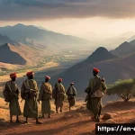
Eritrea’s journey through history is inextricably linked to the ever-shifting lines on its maps, lines that have frequently been drawn, erased, and redrawn, often in the fires of conflict. This isn’t merely academic; these border disputes have real, tangible human consequences, impacting communities and shaping national identity. After gaining independence from Ethiopia in 1993, the exact demarcation of the border became a contentious issue, leading to a devastating war between 1998 and 2000. I remember following these events, feeling the weight of history as maps, once again, became battlegrounds. Ethiopia, at one point, even issued new banknotes with maps that included Eritrean-claimed areas, a clear signal of territorial ambitions. It just goes to show how deeply intertwined cartography is with sovereignty and national pride. The Algiers Agreement in 2000 was meant to resolve these issues, establishing a boundary commission whose decisions were declared binding, yet the implementation remained fraught with challenges for years. For me, examining these contemporary maps, scarred by conflict, brings home the powerful, sometimes heartbreaking, reality that a border is never just a line on paper; it’s a living, breathing entity that impacts lives.
The Eritrean-Ethiopian Border: A Cartographic Battlefield
The border between Eritrea and Ethiopia is perhaps one of the most historically contentious lines on any map I’ve studied. It’s a prime example of how colonial-era delineations, often drawn without sufficient local knowledge or consultation, can create enduring flashpoints. The conflict over territories like Badme, for instance, became symbolic of the broader struggle for national self-determination and territorial integrity. Even after the official end of hostilities and a binding ruling, the actual demarcation remained a challenge for a long time, highlighting the complexities of translating legal decisions onto the physical landscape. What strikes me is how these maps, detailing troop movements, disputed zones, and proposed boundaries, really put a human face on geopolitical struggles. They remind us that behind every line and shaded area are communities, families, and individuals whose lives are profoundly affected by these decisions. It’s a powerful lesson in the real-world impact of cartography.
Maps as Tools of Propaganda and National Identity
It’s no secret that maps can be used as powerful instruments of propaganda, shaping perceptions and reinforcing national narratives. In Eritrea’s context, especially during and after its struggle for independence, maps took on profound symbolic meaning. They weren’t just showing where things were; they were asserting a nation’s right to exist, defining its territorial integrity in the face of historical claims and contemporary disputes. I’ve seen examples where war maps, celebrating victories and strategic maneuvers, are displayed in museums, becoming key symbols of national identity for future generations. This symbolic use of maps, transforming them into emblems of resilience and triumph, is a testament to their enduring power to inspire and unify. It shows us that a map can be much more than a geographical tool; it can be a declaration, a celebration, and a cornerstone of collective memory.
Evolving Landscapes: How Maps Reflect Environmental Shifts
Beyond human conflicts and political boundaries, historical maps of Eritrea also offer a fascinating, albeit often subtle, glimpse into the region’s evolving natural environment. While not always their primary purpose, these old charts can reveal changes in coastlines, the extent of deserts, the presence of various ecosystems, and even the paths of seasonal rivers. When I look at maps from different centuries, I try to discern these environmental narratives. For example, the detailed nautical charts showing the Red Sea coastline can hint at changes in sea levels or sediment deposition over time, even if those weren’t the cartographer’s explicit intent. You start to notice how the portrayal of arid zones or mountainous terrains shifts, reflecting not just improved mapping techniques but potentially long-term ecological transformations. It’s a subtle dance between human interpretation and natural reality, but the patient observer can uncover valuable environmental history etched within these old drawings. It’s a reminder that geography is never static, and our understanding of it is always a work in progress.
Tracing Coastlines and Marine Environments
Eritrea’s extensive Red Sea coastline has always been a defining feature, and its representation on historical maps is particularly insightful. Early maps often show the general outline, but as cartographic techniques improved, you begin to see finer details: coral reefs, islands, and even indications of water depths. These details are invaluable for understanding how marine environments might have changed over centuries. The Dahlak Archipelago, with its numerous islands, is consistently present, but the level of detail regarding individual islands and their formations evolves dramatically across different periods. For someone like me who loves to connect history with geography, tracing these coastal evolutions provides a unique perspective on the interaction between human activity and natural processes, hinting at changes in fishing grounds, shipping lanes, and even ecological health. It makes you realize how much the sea has shaped Eritrea’s past, and how its portrayal on maps captures that enduring relationship.
Depicting Natural Barriers and Resources
Historical maps of Eritrea, even those primarily focused on political or military objectives, inadvertently reveal much about the region’s natural barriers and resources. The central highlands, for instance, a narrow strip rising to over 2,000 meters above sea level, are consistently depicted as a formidable geographic feature, often dictating settlement patterns and transportation routes. Similarly, the western lowlands, characterized by savanna vegetation, are shown distinct from the arid coastal plains. These natural distinctions are not just aesthetic; they profoundly influenced trade, migration, and even colonial strategies. I often find myself appreciating the cartographer’s unspoken narrative in these details – the subtle indications of where water might be scarce, where mountains are impassable, or where fertile land can be found. It’s a silent dialogue between the land and the mapmaker, offering insights into how environmental factors have always played a starring role in Eritrea’s story.
The Cartographer’s Hand: Artistry and Science in Eritrean Maps

When you hold an antique map of Eritrea, you’re not just looking at a geographical representation; you’re often admiring a piece of art and a marvel of scientific endeavor. The cartographer’s hand, whether an anonymous craftsman or a renowned geographer, brought together nascent scientific understanding, observational data, and often, a touch of artistic flair to create these enduring documents. I’ve always been captivated by the sheer skill involved, especially in maps from centuries past where precision was hard-won through grueling expeditions and painstaking measurements. The lettering, the embellishments, the choice of colors – they all speak to an era when map-making was as much a craft as it was a science. You see different scales, prime meridians, and units of elevation being used, reflecting the diverse scientific approaches of different European nations at the time. It’s a testament to human ingenuity and the relentless pursuit of knowledge, a beautiful blend of utility and aesthetic appeal that still resonates today. Personally, I find the stylistic variations between, say, a 19th-century British map and an early 20th-century Italian one to be incredibly telling, each reflecting a distinct cultural and scientific perspective.
From Hand-Drawn Scrolls to Printed Precision
The evolution of map-making technology profoundly impacted how Eritrea was depicted. Imagine the early, hand-drawn maps, perhaps based on traveler accounts or rudimentary surveys, often showing significant distortions but brimming with character. Then, with the advent of printing presses, especially lithography, maps became more uniform, precise, and widely disseminated. This transition from unique, almost artisanal scrolls to mass-produced, standardized prints marked a huge leap in cartographic accuracy and accessibility. It’s truly incredible to trace this progression: from tentative outlines to meticulously gridded territories. I’ve seen some beautifully detailed 19th-century engravings, many from publications like the “Illustrated London News,” that documented British expeditions to the region, showcasing the increasing sophistication of print media in disseminating geographical information. Each technological step brought us closer to the accurate, almost photographic maps we have today, but there’s an undeniable charm and historical richness in the imperfections of those earlier works.
Deciphering Cartographic Symbols and Legends
To truly appreciate historical maps, you have to learn to speak their language, and that means deciphering their symbols and legends. These aren’t just decorative elements; they’re the keys to understanding the cartographer’s intent and the prevailing knowledge of the time. Early maps of Eritrea might feature symbols for caravan routes, water sources, or tribal territories that would be entirely different from modern topographic symbols. I remember one particular map that included a note explaining the pronunciation of Amharic and Arabic letters and transliterated local terms, which was an amazing detail to aid the European reader. Understanding these unique legends is like unlocking a secret code, revealing layers of information about the geography, the people, and even the political climate of the era. It’s a small but significant detail that adds so much to the richness of the historical mapping experience. It’s why I always encourage fellow map lovers to spend extra time with the legend; it often holds the most captivating stories.
Eritrea’s Global Nexus: Connecting Continents on Paper
Eritrea, strategically positioned on the Red Sea, has always been a vital nexus, connecting different continents and cultures long before modern globalization. This global significance is beautifully illustrated in historical maps, which show the region as a crossroads of ancient trade routes, a prize for competing empires, and a critical link between East and West. It’s impossible to look at these maps without understanding that Eritrea was never an isolated entity; it was always deeply intertwined with broader global movements, from the spread of religions to the flow of goods and ideas. I often imagine the flurry of activity at ancient ports like Adulis, seeing how merchants from different lands converged, their routes painstakingly marked on early charts. The opening of the Suez Canal in 1869, for instance, dramatically increased the Red Sea’s strategic and economic importance, making Eritrea even more central to global trade, a fact immediately reflected in contemporary mapping efforts. This perspective truly highlights how Eritrea’s geography dictated its role in a much larger global narrative, a narrative clearly visible when you trace its connections on these venerable maps.
The Red Sea: A Gateway to Global Exchange
The Red Sea has been, for millennia, an indispensable artery of global exchange, and Eritrea’s prominent position along its shores is continually emphasized in historical cartography. Looking at maps detailing the routes between Europe, Africa, and Asia, you can see how the Red Sea served as a crucial corridor, enabling the movement of silks, spices, precious metals, and cultural influences. This wasn’t just about economics; it was about the diffusion of knowledge, technology, and belief systems across vast distances. The intricate lines on these old nautical charts, marking safe passages and important ports, are silent witnesses to countless journeys that shaped civilizations. I find it absolutely captivating to see how the Red Sea’s significance hasn’t waned over time; it’s a constant, enduring feature in global cartography, a testament to Eritrea’s immutable role in world history as a maritime gateway.
Eritrea in the Context of Regional Empires
Historical maps often place Eritrea within the shifting geopolitical landscapes of regional empires, illustrating its relationships with powerful neighbors. Before the colonial interventions, parts of Eritrea were under the influence of the Kingdom of Aksum, and later, the Ethiopian Empire, which sought control over its valuable Red Sea coast. These maps, even when drawn by external powers, provide clues about the fluctuating spheres of influence and the complex power dynamics at play. They show how the region known as Medri Bahri (“Sea land”) with its Bahr Negash (“King of the Sea”) governor, was a distinct entity often contested by highland kingdoms for its access to the coast. It’s a dynamic picture, revealing a history of fluid borders and competing claims that long predates European arrival. Understanding these intricate regional connections through maps truly enriches my appreciation for Eritrea’s deep and multifaceted past, demonstrating its resilience and constant importance in the Horn of Africa.
| Era/Influence | Key Cartographic Features | Impact on Eritrea’s Depiction |
|---|---|---|
| Ancient (Pre-16th Century) | Trade routes, major settlements (e.g., Adulis), rough coastal outlines, often within larger regional empires like Aksum. | Reveals Eritrea’s early role as a trade hub; fluid internal boundaries and connections to broader regional powers. |
| Ottoman/Egyptian (16th-19th Century) | Detailed Red Sea coastline, ports like Massawa, emphasis on maritime control and strategic points. | Highlights Eritrea’s coastal areas as contested territories; growing importance of Red Sea access. |
| Italian Colonial (Late 19th – Mid 20th Century) | Precise internal administrative boundaries, infrastructure (roads, railways), planned urban centers (Asmara), military strategic points. | Establishes modern-day territorial boundaries; showcases colonial development and resource exploitation. |
| Post-Independence (Late 20th – 21st Century) | Focus on national sovereignty, disputed borders, ethnic distributions, and resource mapping for development. | Reflects ongoing challenges of border demarcation; emphasizes national identity and development goals. |
Preserving the Past: The Future of Eritrean Cartographic Heritage
As we navigate the digital age, the way we interact with historical maps of Eritrea is undergoing a fascinating transformation. What was once confined to dusty archives and specialized collections is now becoming increasingly accessible online, allowing more people than ever to explore this rich cartographic heritage. This shift isn’t just about convenience; it’s about democratizing access to history and ensuring that these invaluable documents continue to tell their stories for generations to come. I truly believe that digitizing these maps, meticulously scanning and cataloging them, is an act of profound historical preservation. It protects delicate originals from further decay while simultaneously opening them up to a global audience of researchers, enthusiasts, and even casual explorers like myself. There’s something truly special about being able to zoom in on a 19th-century map from my living room, noticing details that might have been impossible to see in person, and connecting with the past in a way that feels both intimate and expansive. It’s an exciting time to be a map lover, with technology bridging the gap between historical artifacts and modern curiosity.
Digital Archives: Unlocking Historical Maps Online
The advent of digital archives has been a game-changer for anyone interested in historical maps, and Eritrea’s cartographic past is a prime beneficiary. Websites and institutional databases are increasingly making high-resolution scans of these precious documents available, often with detailed metadata that helps contextualize them. This means that maps once hidden away in European libraries, documenting colonial ambitions or early explorations, are now just a few clicks away. I’ve spent countless hours diving into these online collections, discovering incredible pieces like old British Admiralty charts or rare Italian colonial maps that I never would have encountered otherwise. It’s an empowering experience, allowing for cross-referencing and comparative study that was previously difficult and time-consuming. The ability to explore these historical layers from anywhere in the world truly underscores the power of digital preservation in safeguarding and sharing our collective human story, especially for regions like Eritrea with such a complex and layered history.
The Educational Value of Antique Maps
Beyond their aesthetic appeal and historical significance, antique maps of Eritrea hold immense educational value. They offer tangible, visual lessons in geography, history, and even linguistics and cultural studies. For students, seeing how borders have changed, how cities have grown, or how different languages were represented on maps can bring abstract historical narratives to life in a vivid, unforgettable way. I’ve often thought about how these maps could be used in classrooms, inspiring a deeper curiosity about the world and its intricate past. They’re not just static images; they’re conversation starters, prompts for critical thinking, and powerful tools for understanding the forces that shaped our present. From understanding the strategic importance of the Red Sea to appreciating the complexities of colonial legacies, these maps provide a unique and engaging pathway to knowledge. It’s about more than just dates and names; it’s about experiencing history through the eyes of those who charted it.
글을 마치며
Well, my fellow history buffs and map enthusiasts, what an incredible journey we’ve taken through Eritrea’s rich cartographic past! It truly humbles you to see how every line, every symbol, tells a story of human endeavor, conflict, and connection.
These aren’t just old documents; they’re windows into the souls of past civilizations and the tireless work of cartographers who helped us understand our world.
I hope this deep dive has ignited your own curiosity to explore the hidden narratives in maps, reminding us that history is alive, waiting to be discovered, one parchment at a time.
Keep exploring!
알아두면 쓸모 있는 정보
1. Start with the Source: Whenever you dive into historical maps, my number one tip is to try and understand the origin. Who made it? For what purpose? Knowing if it was a colonial survey, an explorer’s record, or a local depiction drastically changes how you interpret its details and biases. It’s like getting to know the artist behind the masterpiece – it adds so much context to what you’re seeing and helps you spot the hidden agendas or assumptions embedded within the cartography. I’ve personally found this makes a huge difference in appreciating the map’s true historical value, moving beyond just its geographical data to its human story. Understanding the source of a map can provide critical insights into its accuracy and the perspective it represents.
2. Look Beyond the Borders: While national boundaries dominate modern maps, older Eritrean maps often reveal fascinating details about natural features like rivers, mountain ranges, and seasonal pathways that shaped early societies and trade. Pay attention to how these natural barriers or resources are depicted, as they often dictated human settlement, migration, and even the course of conflicts long before arbitrary lines were drawn on paper. It’s a great way to understand the inherent power of geography and how it truly influenced life and interaction in the region for centuries. Eritrea’s varied landscape, from highlands to coastal plains, significantly impacted its historical development and is reflected in early cartography.
3. Digital Archives are Your Friend: You wouldn’t believe the treasures waiting in online digital archives! Institutions worldwide are digitizing their historical map collections, making them accessible to everyone. Websites of national libraries, university collections, and specialized map archives are goldmines for high-resolution scans of Eritrean maps from various eras. I’ve spent countless evenings just browsing these collections, discovering maps I never knew existed, and believe me, it’s an absolute thrill to stumble upon a rare 18th-century chart that illuminates a forgotten aspect of the Red Sea trade. Digital archives like OldMapsOnline offer a vast collection of historical maps of Eritrea, making them easily discoverable.
4. Decipher the Legends: Don’t skip the legend! It’s like the instruction manual for your historical map. Different eras and cartographers used unique symbols, scales, and even language conventions that might seem unfamiliar today. Taking the time to understand these keys will unlock layers of information about topography, settlements, resources, and even the political climate of the time. Trust me, I’ve missed crucial details before because I was too eager to just look at the geographical layout, only to realize the real insights were in the fine print of the legend. Legends are crucial for interpreting the cartographer’s intent and the prevailing knowledge of the period.
5. Compare and Contrast: To truly appreciate the evolution of Eritrea’s landscape and its portrayal, compare maps from different periods. Laying a 17th-century map next to a 19th-century one, and then a contemporary satellite image, reveals incredible changes in understanding, detail, and even environmental shifts. You’ll notice how coastlines were refined, how internal regions became more accurately delineated, and how the emphasis shifted from trade routes to colonial administration, offering a dynamic visual history lesson that’s far more engaging than any textbook. This comparative approach has personally revolutionized how I view historical geography, showing how maps served different functions, from practical navigation to symbolizing national feeling.
중요 사항 정리
In wrapping up our exploration of Eritrea’s cartographic journey, it’s clear that maps are far more than mere geographical guides. They are living historical documents, each bearing the indelible marks of ancient empires, colonial ambitions, and the enduring resilience of a nation forged by its strategic position on the Red Sea. We’ve seen how early charts highlighted vital trade routes, reflecting Eritrea’s role as a global nexus long before modern globalization. The colonial era transformed these depictions, using maps as instruments of power to redraw borders and assert control, leaving a complex legacy that still resonates today. Crucially, Eritrea’s contested lines on modern maps underscore the profound human impact of cartographic decisions and the ongoing struggle for sovereignty. Lastly, the artistry and scientific precision of cartographers across centuries remind us that these documents are cultural treasures, now increasingly accessible through digital preservation, offering invaluable insights into the evolving landscape and the deep, multifaceted history of Eritrea. What a rich tapestry these maps weave, connecting past to present and inviting us all to look closer at the stories held within their folds!
Frequently Asked Questions (FAQ) 📖
Q: Why are historical maps of Eritrea so important for understanding its past and present?
A: Oh, this is such a fantastic question! For me, personally, diving into Eritrea’s historical maps was like finding the missing pieces to a giant puzzle.
These aren’t just pretty pictures of land; they’re vibrant narratives etched in ink and parchment, showcasing the incredible depth of Eritrea’s history.
When you look at an old map, you don’t just see mountains and rivers; you see the rise and fall of ancient kingdoms like the mighty Kingdom of Aksum, which thrived as a major trading empire, covering much of modern-day Eritrea and northern Ethiopia from the 1st to 10th centuries AD.
You can literally trace the strategic importance of its Red Sea coast, a lifeline for trade that attracted countless powers, from the Ottomans to European colonialists.
It truly helps you grasp how this resilient nation’s identity was forged through centuries of indigenous cultures and external influences. I remember feeling a genuine connection to the past, realizing how the physical lines on a map, whether showing ancient caravan routes or shifting borders, directly impact the cultural and political landscape of Eritrea today.
It gives you this profound sense of continuity, and frankly, makes history feel incredibly alive!
Q: Where can enthusiasts and researchers find reliable historical maps of Eritrea?
A: You’re probably wondering where to start your own cartographic adventure, right? Well, I’ve had a blast exploring various archives, and let me tell you, there are some real gems out there!
My personal go-to for a broad overview is often the Library of Congress, which holds some excellent historical maps, including detailed ones of Eritrea.
Another fantastic resource I’ve stumbled upon is Wikimedia Commons’ “Atlas of Eritrea,” which is a goldmine of historical maps illustrating former countries and empires that encompassed the region.
If you’re really looking to dig deep, online platforms like OldMapsOnline are incredible; they allow you to explore a vast collection of historical maps, often from various archives worldwide, related to specific regions of Eritrea.
And here’s a little insider tip: if you ever get the chance to visit Eritrea, the Northern Red Sea Regional Museum in Massawa reportedly houses some fascinating war maps, which offer a unique perspective on the nation’s fight for independence.
It’s like a treasure hunt, and finding these old charts feels like discovering a piece of hidden history every single time!
Q: How did the colonial period specifically influence Eritrea’s boundaries and national identity as depicted in maps?
A: This is where things get really intriguing, and honestly, a bit heartbreaking, as you see the stark reality of how external powers literally redrew destinies.
The colonial era, particularly Italian rule, played a monumental role in shaping the Eritrea we know today. Prior to Italian colonization, the region was a tapestry of different entities and influences, from the Ethiopian highlands to Ottoman-controlled coastal areas.
But then, Italy formally established the Colony of Eritrea around 1889-1890, and with that came the systematic mapping of its new administrative boundaries.
These maps, often drawn with European interests in mind, essentially defined the modern borders of the country. I’ve seen some of these Italian colonial maps, and it’s fascinating how they sometimes served a dual purpose – not just geographical representation, but also as propaganda, asserting control and vision for their African empire.
While these colonial lines were initially drawn by foreign powers, they inadvertently fostered a distinct Eritrean identity, separate from its neighbors.
Later, these very colonial maps became central to border disputes, especially with Ethiopia, highlighting how decisions made over a century ago continue to resonate.
It’s a powerful reminder that maps aren’t just static images; they are deeply intertwined with geopolitical shifts and the enduring spirit of a nation.